
The repository will be read-only during the migration (code freeze). No submissions or edits will be possible during this time.
- Atmire
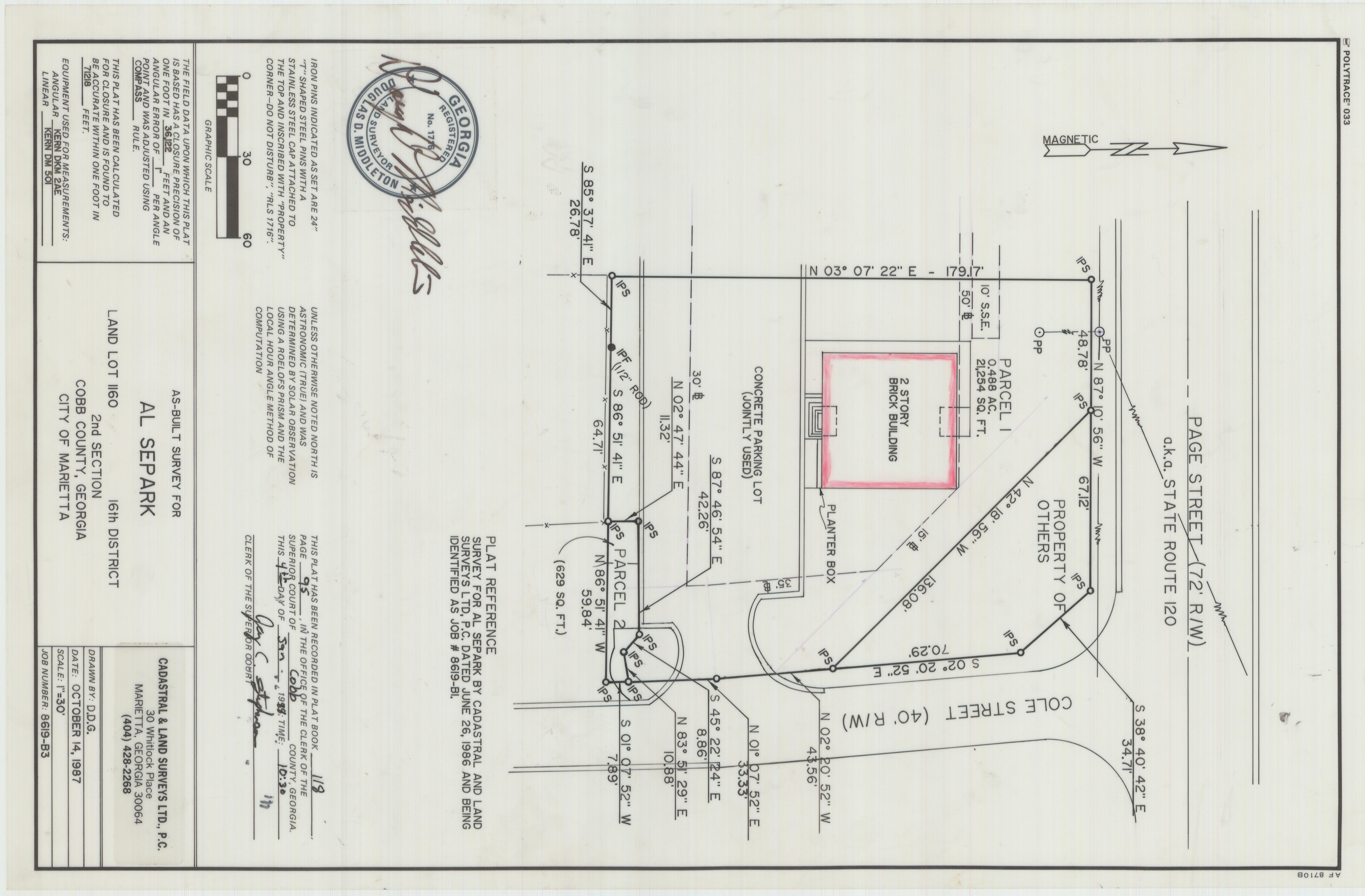
As-Built Survey for Al Separk, Page Street
| dc.contributor.author | Cadastral & Land Surveys Ltd. | |
| dc.contributor.other | Separk, Al | |
| dc.coverage.spatial | Cobb County (Ga.) | |
| dc.date.accessioned | 2021-10-22T15:42:41Z | |
| dc.date.created | 10/14/1987 | |
| dc.date.issued | 2021-10-22T15:42:41Z | |
| dc.date.issued | 2021-10-22T15:42:41Z | |
| dc.date.issued | 2021-10-22T15:42:41Z | |
| dc.identifier | 8619-B3 | |
| dc.identifier.citation | As-Built Survey for Al Separk, Page Street, 1987, Douglas D. Middleton survey maps, 1970-1992, SC/M/008, Kennesaw State University Archives. | |
| dc.identifier.uri | https://soar.kennesaw.edu/handle/11360/6562 | |
| dc.description | As-built survey for Al Separk created on October 14, 1987. The lot is located along Page Street (State Route 120), in land lot 1160, 16th district, Cobb County. | |
| dc.description.abstract | As-built survey of land lot 1160 of the 16th District, 2nd Section, Cobb County, Georgia | |
| dc.format.mimetype | image/jpeg | |
| dc.language.iso | en_US | |
| dc.relation.ispartof | http://archivesspace.kennesaw.edu/repositories/4/resources/434 | |
| dc.rights | Kennesaw State University's Department of Museums, Archives & Rare Books provides the information contained on this site for non-commercial, personal, or research use only. All other use, including but not limited to commercial or scholarly reproductions, redistribution, publication or transmission, whether by electronic means or otherwise, without prior written permission of the copyright holder is strictly prohibited. | |
| dc.subject | Cobb County (Ga.)--Surveys | |
| dc.subject | Surveying | |
| dc.subject | Land subdivision | |
| dc.subject | Real property--Maps | |
| dc.title | As-Built Survey for Al Separk, Page Street | |
| dc.type | image |
Files in this item
This item appears in the following Collection(s)
-
Douglas D. Middleton survey maps, 1970-1992
A sampling of the approximately 1,500 maps in the collection showing land surveys conducted in northwest Georgia between 1970 to 1992.